Thermal Assisted Aerial Control Program 2025
The ACT Parks and Conservation Service (PCS) will be conducting their annual Thermal Assisted Aerial Control (TAAC) program to remove vertebrate pest species from key conservation areas, water catchments and semi urban areas in the ACT.
Closures will be in place from Thursday 8 May to Friday 30 May 2025 during operations. Dates and maps of closures are below.
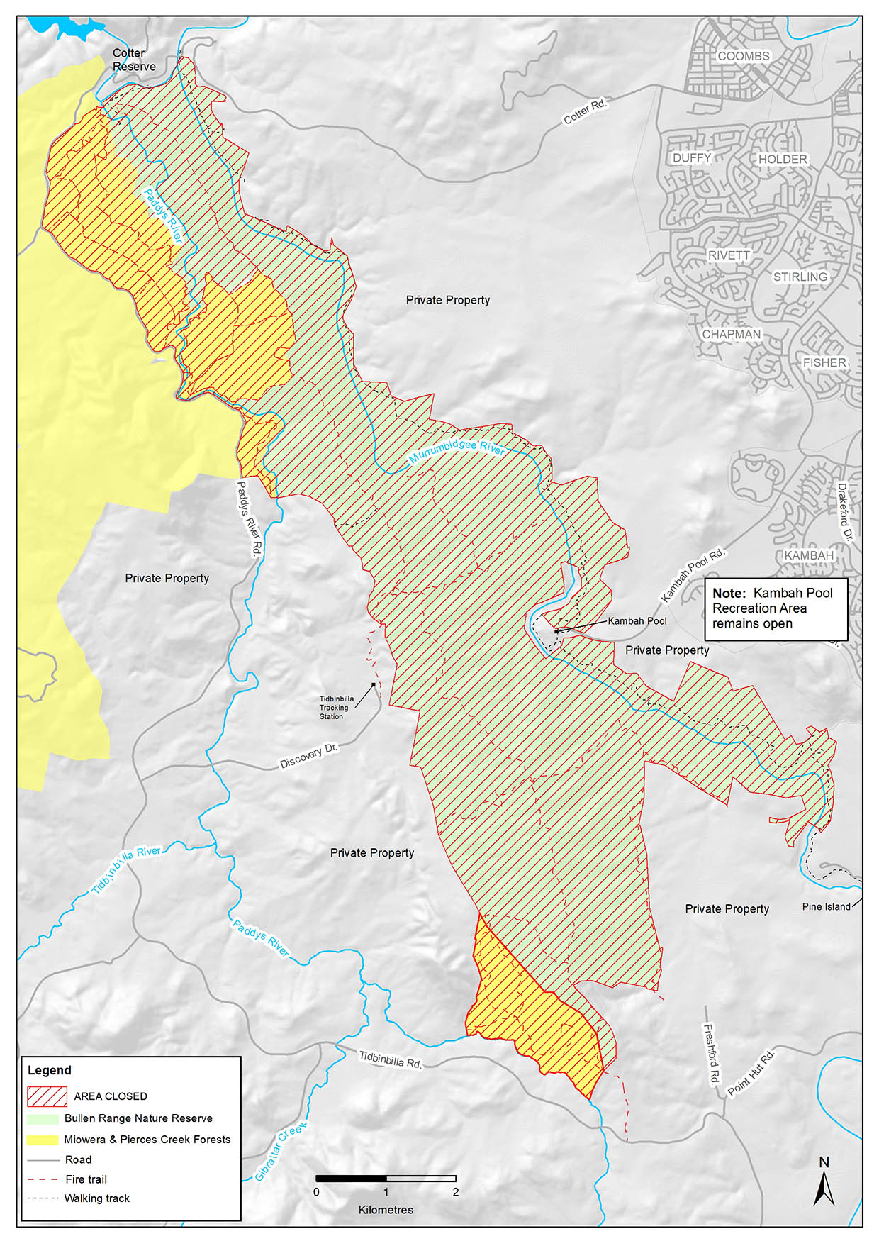
Bullen Range Nature Reserve
Closed from 8 May to 18 May.
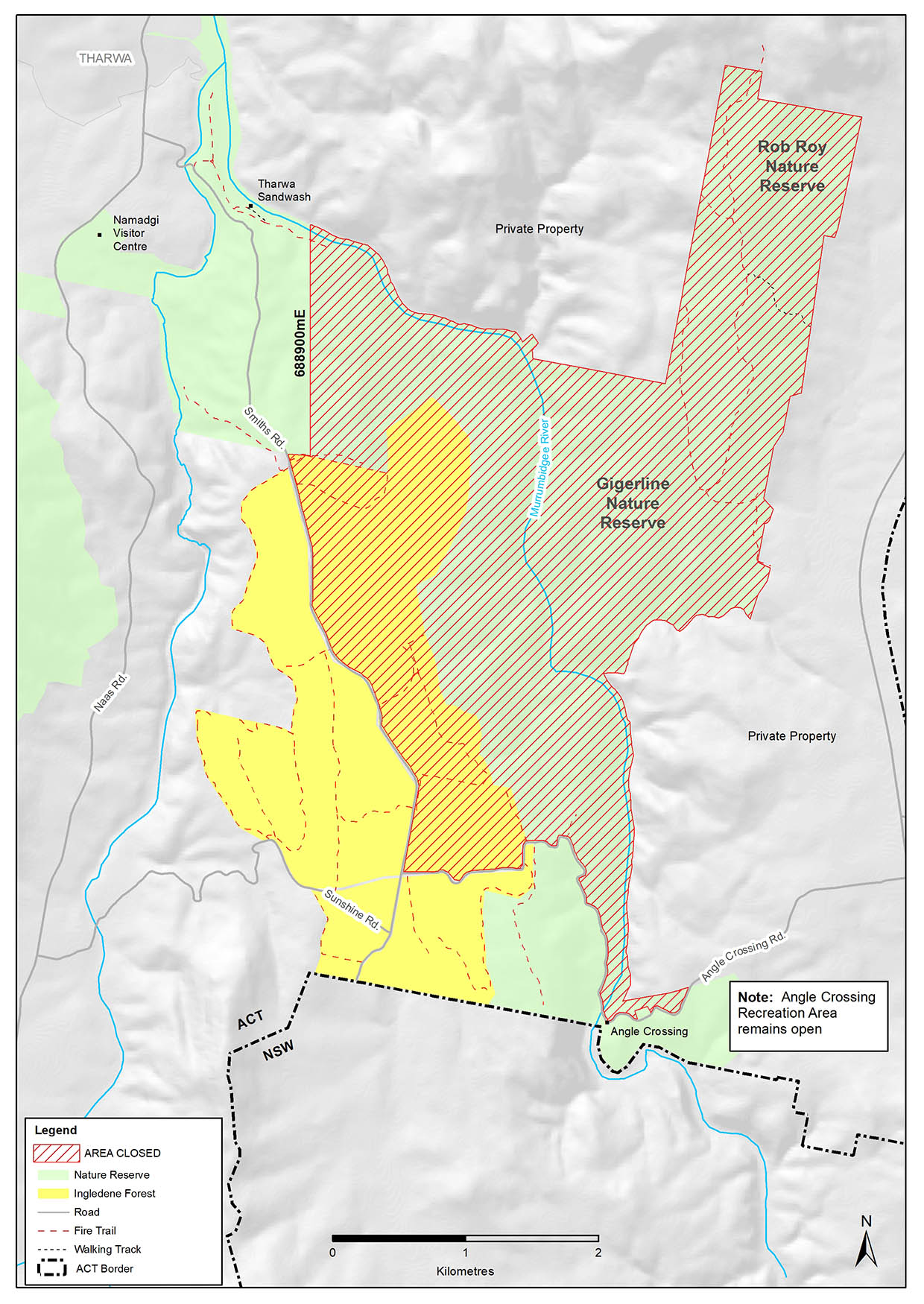
Gigerline Nature Reserve and Rob Roy Nature Reserve (south)
Closed from 8 May to 18 May.
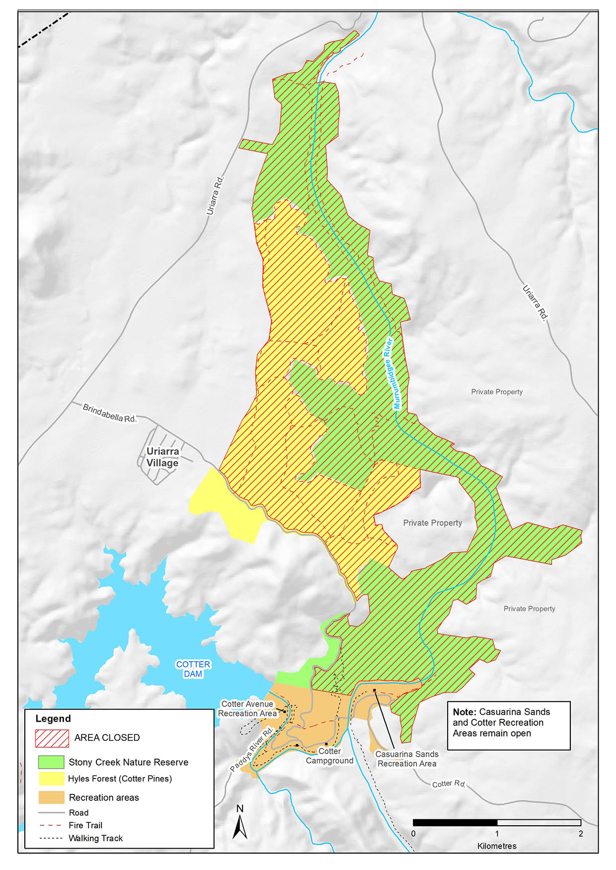
Stony Creek Nature Reserve
Closed from 8 May to 16 May.
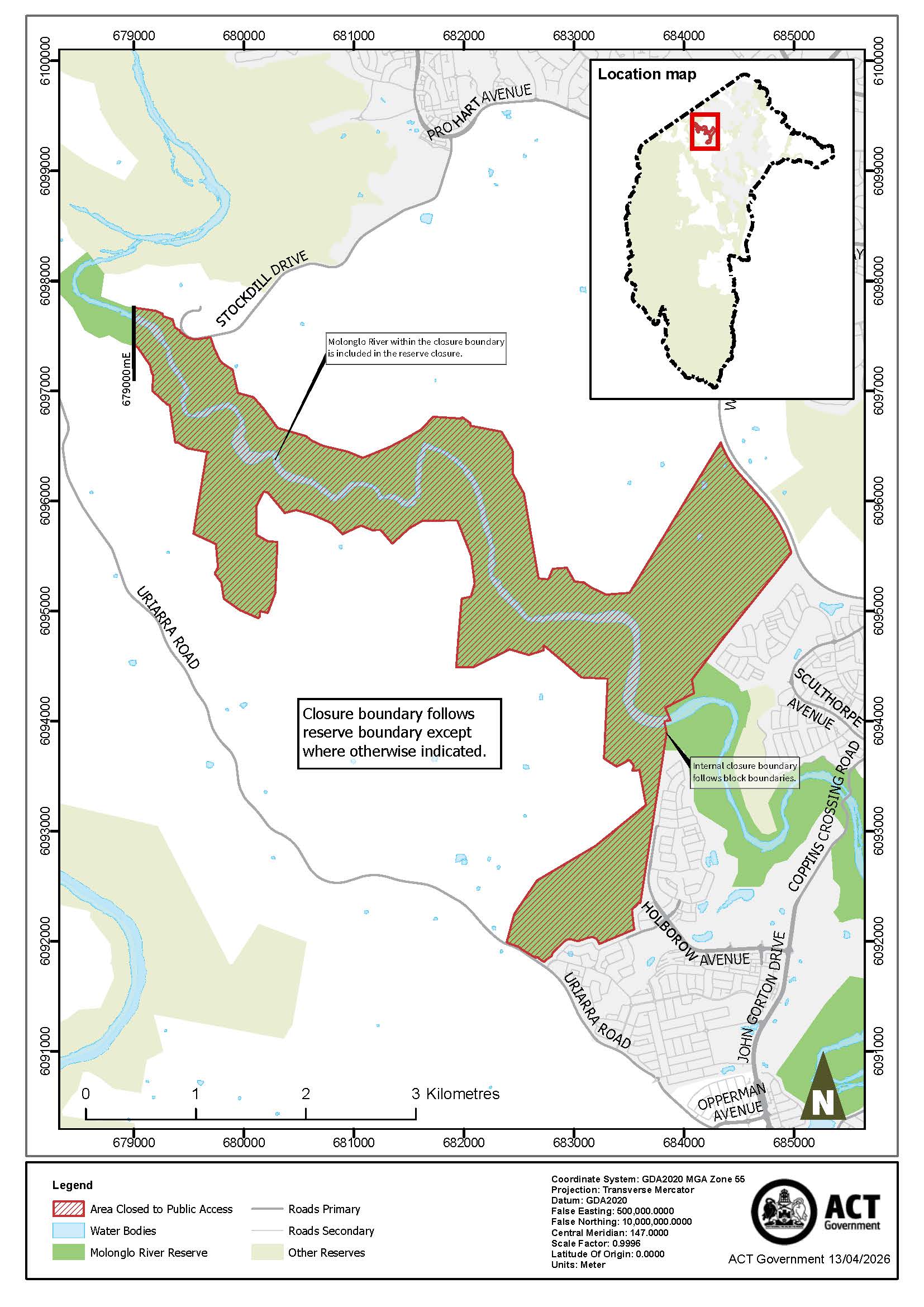
Molonglo River Reserve
Closed from 12 May to 16 May.
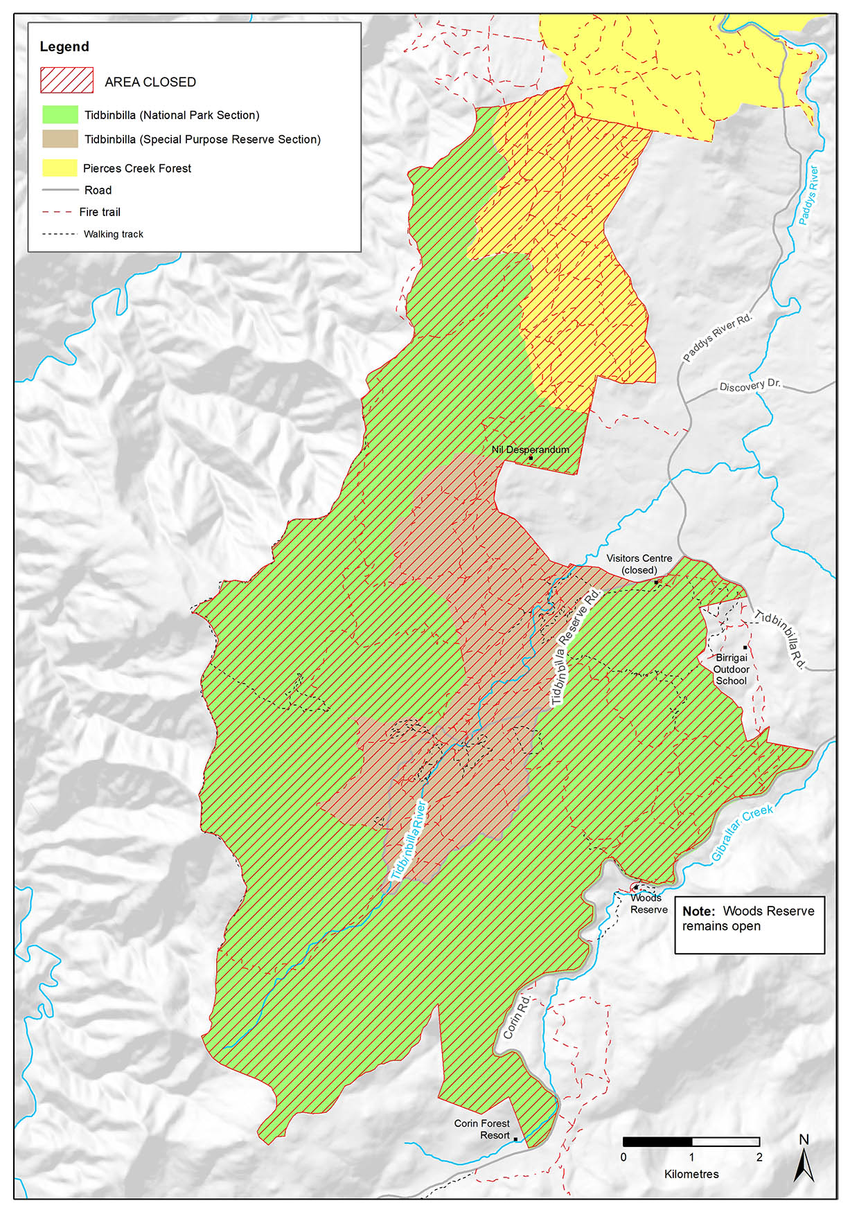
Tidbinbilla Nature Reserve
Closed from 15 May to 16 May.
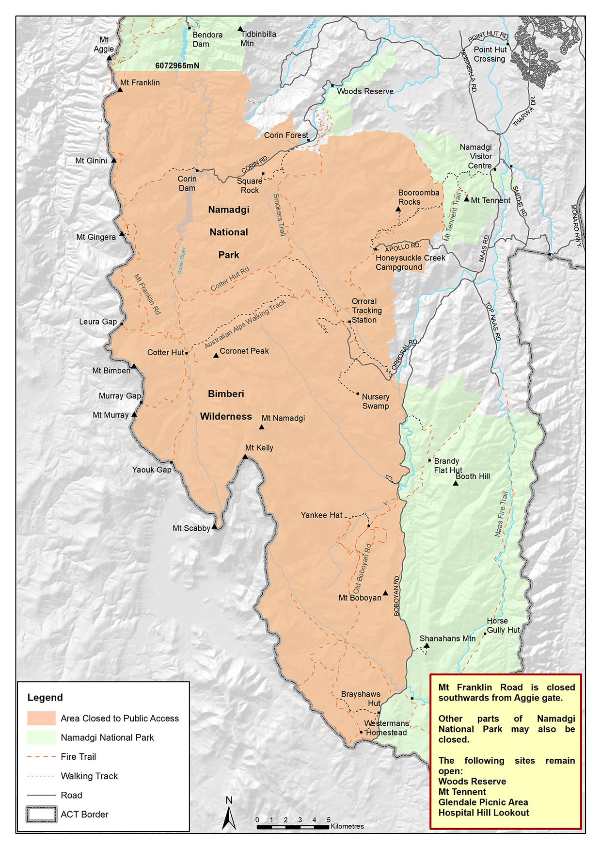
Namadgi National Park (West)
Closed from 16 May to 27 May.
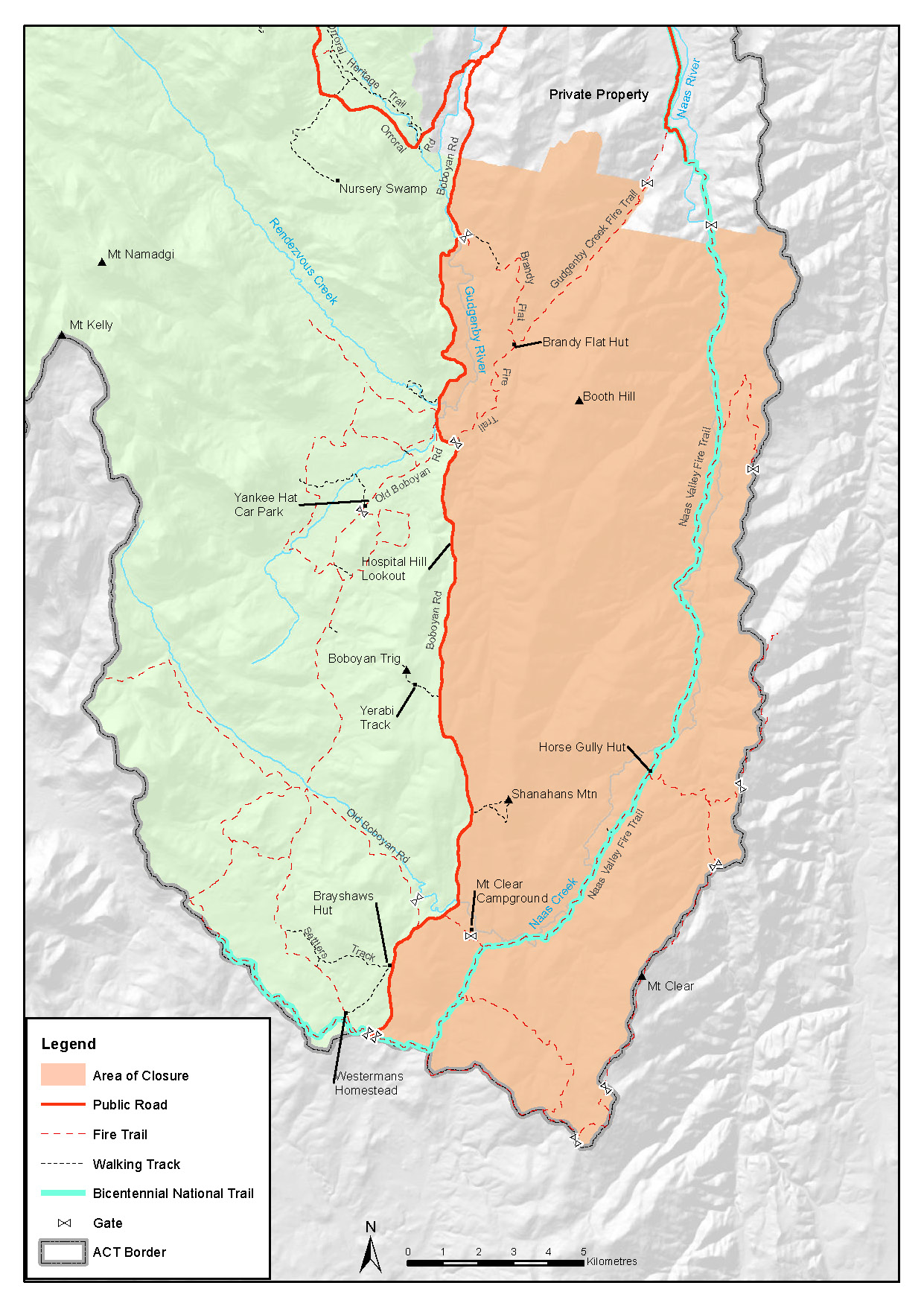
Namadgi National Park (Naas – East)
Closed from 19 May to 28 May.
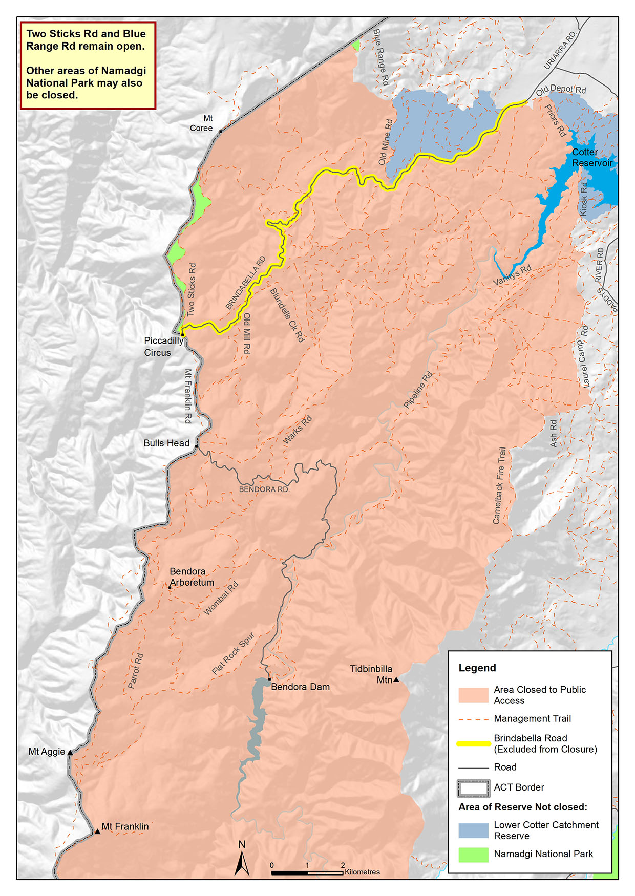
Namadgi National Park (North) and Lower Cotter Catchment
Closed from 19 May to 28 May.
Googong Foreshore
Closed from 26 May to 30 May.
Map coming soon.